Connect BIM, CAD, and GIS data to improve collaboration
and deliver smarter infrastructure.

Every sector faces unique challenges. Explore your industry to see how we help organisations improve visibility, make informed decisions, and deliver better
long-term outcomes.
Connect BIM, CAD, and GIS data to improve collaboration
and deliver smarter infrastructure.

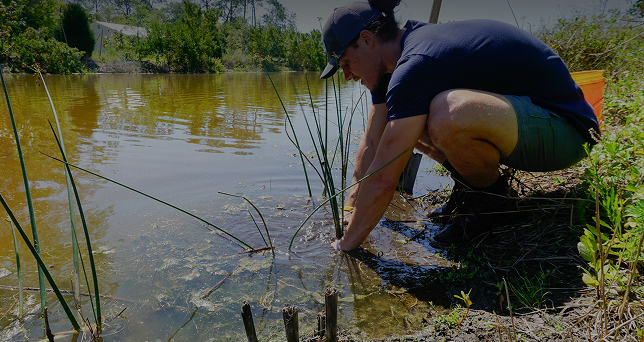
Improve agribusiness visibility with connected land, operational, and environmental data.

Gain deeper market, customer, and property insight to
support smarter commercial decisions.

Enable spatial learning, research, and campus management
with enterprise GIS technology.

Improve network visibility, outage response, and infrastructure planning with enterprise GIS.

Cultural mapping, iwi resource management,
and Treaty settlement spatial analysis.
Impact mapping, volunteer coordination, and programme
delivery for the community sector.

Improve council planning, asset management, and service delivery with spatial intelligence.

Connected GIS and AI for better government planning,
operations, and policy outcomes.

Network planning, outage management, and real-time
spatial visibility across telecommunications infrastructure.
Improve network visibility, outage response, and infrastructure planning with enterprise GIS.
Improve council planning, asset management, and service delivery with spatial intelligence.
See how organisations are using GIS and spatial technology to make more informed decisions with Eagle Technology.
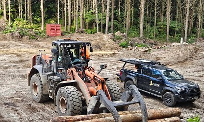
Eagle enabled live data, communications, and machine visibility across 190,000 hectares of forest.
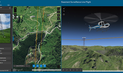
Eagle helped Clarus digitise aerial inspections with ArcGIS, improving speed, accuracy, and visibility.

Pocket Maps gives hunters, trampers, and anglers offline access to trusted public land maps in the field.