Geospatial technology is a critical enterprise capability for modern local government, enabling informed decision-making, operational efficiency, and enhanced service delivery. Auckland Council provides a leading example of how strategic investment in geographic information systems (GIS) can deliver measurable organisational, economic, and societal value supported by evidence and executive alignment.
Geospatial as a Foundational Capability
Auckland Council operates within a uniquely complex environment characterised by rapid urban growth, environmental pressures, and diverse infrastructure demands. Serving approximately 1.8 million residents, the organisation relies heavily on geospatial data to inform activities ranging from planning and regulatory compliance to emergency management and environmental monitoring.
With over 3,000 staff who are frequent geospatial technology users and widespread adoption across council functions, geospatial technology provides a common analytical framework that integrates disparate datasets into a single, location-based system. This capability enables a shared understanding of place, significantly enhancing the quality and consistency of decision-making.
Demonstrating Value Through Measurable Outcomes
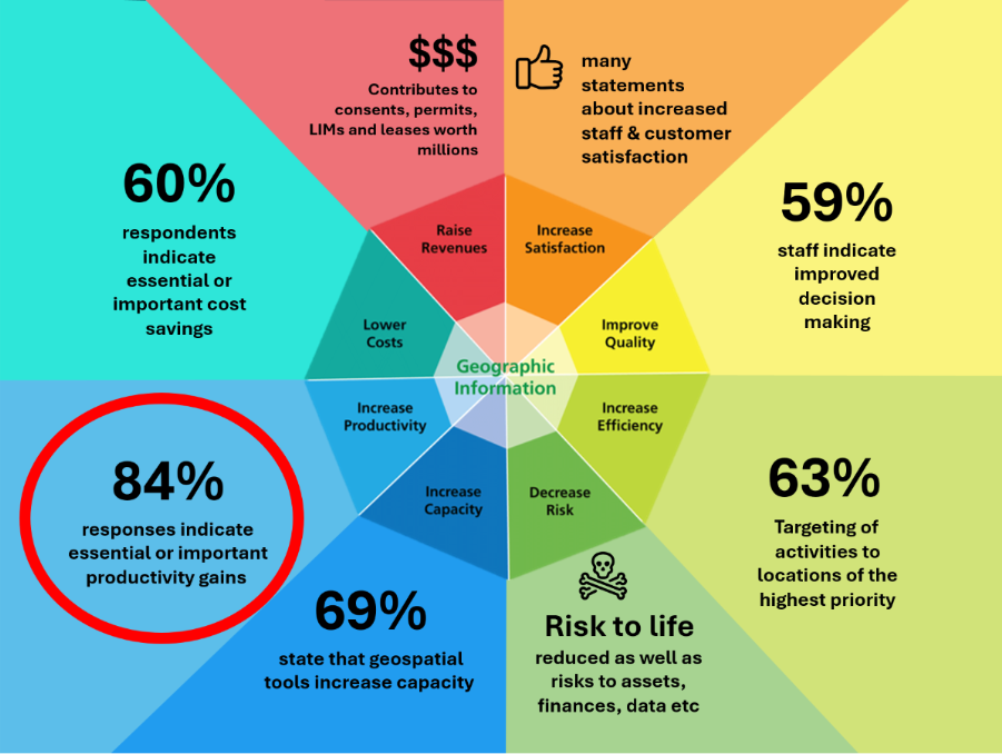
A defining feature of Auckland Council’s approach has been its ability to quantify the return on investment (ROI) of geospatial technology. Through one of the most comprehensive organisational studies undertaken globally, the council established a clear evidence base linking GIS capability to productivity, compliance, and decision-making outcomes.
Key findings include:
- 84% of internal users report productivity gains
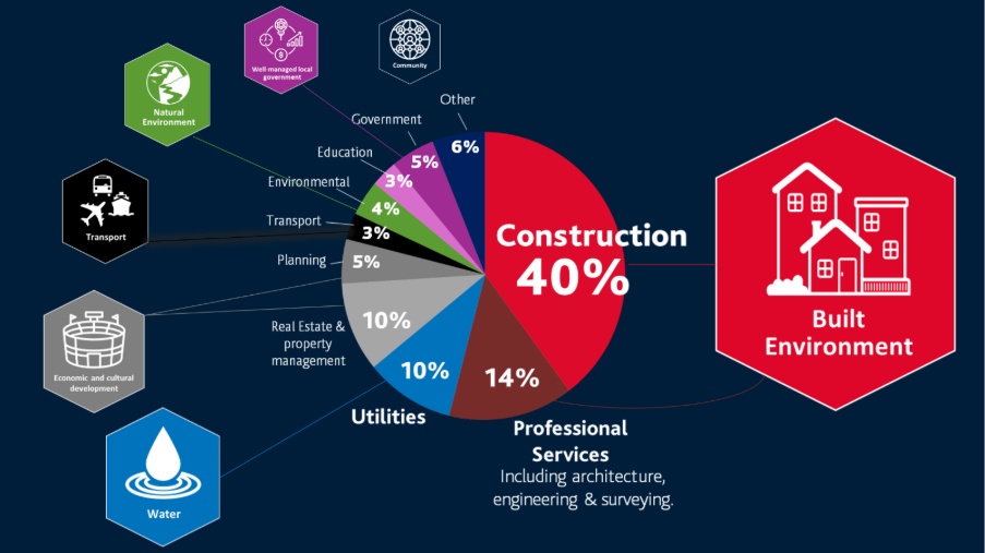
- 91% of external professional users consider GIS essential or important to their workflows
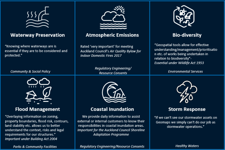
- 100% identify geospatial as essential for legislative compliance
These results provided a compelling business case for continued investment, enabling the council to secure funding for advanced datasets such as high-resolution aerial imagery and LiDAR, as well as next-generation analytical tools.
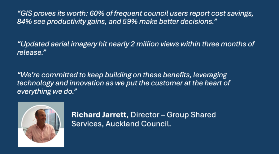
Richard Jarrett, Director of Group Shared Services at Auckland Council, reinforces this evidence-driven perspective:
“GIS proves its worth: 60% of frequent council users report cost savings, 84% see productivity gains, and 59% make better decisions with GeoMaps.”
This emphasis on quantifiable outcomes has been instrumental in elevating geospatial from an operational service to a strategically funded capability.